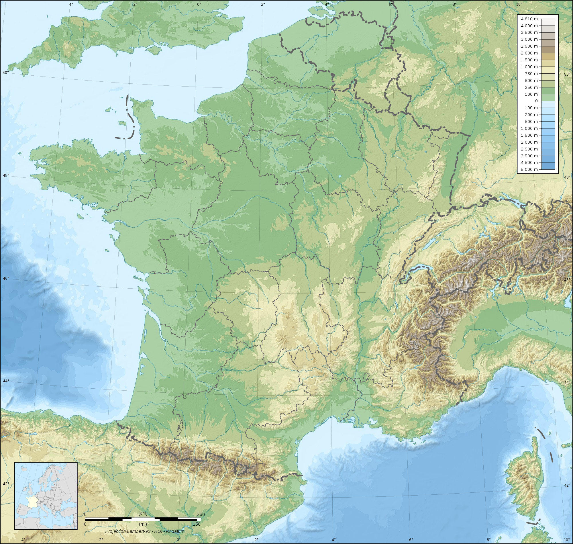
immagine Mappa della Francia

immagine Mappa della Francia
Clipart di Francia topografica con differenze di altitudine verdi e marroni e corpi idrici visibili. Da scaricare e stampare gratuitamente.


Categoria: immagine Mappe > Mappa della Francia
Parole chiave: Mappa della Francia
Image information
Attribution and Share-Alike required
Any use of this map can be made as long as you credit me (Eric Gaba – Wikimedia Commons user: Sting) as the author and distribute the copies and derivative works under the same license(s) that the one(s) stated below. A message with a reply address would also be greatly appreciated.
Sources of data:
- Topography: NASA SRTM30 (public domain);
- Bathymetry: NGDC ETOPO1 (public domain);
- Additional data: NGDC World Data Bank II (public domain).
Blank topographic map of France in the official Lambert-93 projection, with regions boundaries.
Tutte le immagini possono essere utilizzate a scopo personale, educativo e non commerciale.
Per qualsiasi altro uso delle immagini, consulta la Licenza Immagini e/o le Condizioni d'uso.
Non esitare a contattarci per ulteriori informazioni.